Friday, July 13, 2012

Improving north-south connectivity around Campus

First of all, you shouldn't be driving around the U's campus. Any half-brained moron who has lived around the area or has attended classes there for more than the first couple weeks of Football Centrism in September should know that having a car on campus is dumb. (And actually, I'm personally guilty, even though I only use it to go to places like this.)

But for those of you who do drive, you probably know how difficult it is to navigate within the campus. With Washington now closed, the two main arteries into the campus are Huron from I-94 and University/4th from I-35W. (Univeristy from MN-280 would be the other, but I think you might want to avoid that for now.) Driving access from these two segments are relatively easy from the freeway, but once on campus, navigation is near impossible nowadays. In reality, this is a great effort by the University to make the area much denser, more multi-modal and more pedestrian and biking-friendly. Still, vehicles take up a large quantity of trips, and should be accounted as such.

Through campus, the mainly East-West routes of University/4th is sufficient enough to handle traffic in those directions. Hennepin Avenue and Como Avenue serve this function on the north end of campus, as well as I-94 and Franklin to the south. Since the reconfiguring of the intersection and the removal of the parking lane, Fulton St/East River Road does a nice job connecting the Huron freeway ramp to the garages near Comstock as well (Even though I hate the new 4-lane feel... Bikers, beware), and Elm/Kasota Avenue does a nice job sneaking though an industrial park to be a vital artery too. A map showing these routes can be seen here.

However, the north-south connectivity is truly lagging, both within campus and near it. MN-280 is too far to the east to make a significant impact. 15th Avenue, probably the main north-south arterial into campus, makes an abrupt end at Como Avenue. I-35W does a sufficient job initially, but curves east toward Roseville north of Hennepin. The only real north-south route that stays true is 10th Ave (19th Ave on the West Bank), and even this weaves awkwardly through I-35W until it turns into Johnson near the Quarry. Harvard is the only vehicluar street through campus, and it truly is a pain - with Washington now out of the picture, it is now a very inefficient street. I'm sure the University Hotel and the Washington Ramp feel the same way.

So, how do we fix it? If I had all the money in the world and doing-power in MNDOT or MPLSDOT of GOPHERDOT or whatever, here are some of my proposals:

1) Make Harvard go somewhere.

Background: If we were able to connect Harvard to University / 4th, cars could be diverted off of 17th / Church and create an even more pedestrian friendly feeling closer to the heart of the Northrop Mall. Still part of the original street grid at Washington, the road was connected back in 2010 when the segment around the new Rec Center was connected to Pillsbury, as the now irrelevant Union Street was closed off. This helped, but it still awkwardly loops around Civil Engineering and the Armory before ending at Church.


From 2009 Update to U of MN Campus Master Plan.

How to build it: The University's most recent Campus Master Plan (caution: large PDF), compiled in 2009, calls for the demolition of several buildings to improve efficiency. One of these buildings is the aging Fieldhouse, where Barack Obama spoke in 2010. If demolished, this would instantly open up the opportunity for Harvard to grow directly north to University, and if properly connected to 18th Avenue, it would also connect to 4th Street. Although on-street parking would be taken off of 18th, this would free up some traffic from Church / 17th, and would allow for a much more pedestrian-friendly feel on Church, and a bike lane or widened sidewalk could be put in place. With more traffic allowed along Harvard, this would relieve frustrated out-of-towners from accessing the University Hotel, East Bank LRT Station, or Stadium Village Businesses. The only problem with this fix would be a feeling of divide between the Rec Center/Alumni Center to the rest of campus, although those rec center athletes can just dodge traffic if need be, right?


Unless the Obama speech automatically puts the Fieldhouse in Historic designation...

2) Connect East River Road with 2nd Street SE over the Dinky Ditch.

Background: This connection has been on the talking table for some time, as it would be the last link of connecting the East River Road segment of the Grand Rounds to Old St Anthony and Historic Main Street (Home of my favorite movie theater). Currently, East River makes an about-face turn near Education Sciences and snakes to connect to 14th Ave just outside Dinkytown. 2nd Avenue SE ends at 11th Street, where it connects to University near Sanford Hall.

How to fix it: Build a bridge from the Education Sciences Building into the Dinky Ditch, and either connect to 2nd Avenue SE or to the frontage road which evenutally becomes the brick-lined Main Street. If somehow connected to I-35W or the 10th Street Bridge, this would allow for more traffic to be diverted away from University Ave and along the riverfront. Most of this traffic would probably be heading to the Art Museum or East River Garages. This connection would also allow the continuation of Horace Cleveland's masterpiece that is the Grand Rounds, and would allow bikers and pedestrians from Main Street to head straight to the campus without walking down busy University Avenue. I think all those Nice Riders would be pleased.

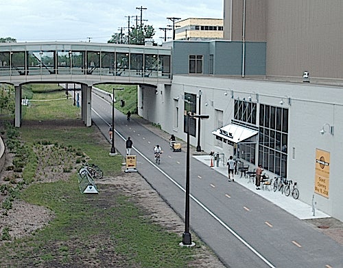
I can't think of a clever caption for this one, I just think it's cool. That's all.
3) Make Oak Street go somewhere: Connect it to 18th Ave / Stinson in Como.

Since Minneapolis seems to be in the mood to build controversial bridges over old rail routes, why not give the University Area a chance too?

Background: The original Minneapolis street grid in this area did not originally have the large train yard north of campus, and in fact had plans to build a larger Como neighborhood. A 1912 Real Estate map of the area shows that Oak was originally supposed to connect with 18th Avenue south of Como Avenue, and continue northward until it turned into Stinson Boulevard. When I realized this, it made complete sense: Oak is perfectly lined up with 18th. Right now, 18th Ave ends anticlimactically at Elm Street, and Oak ends north of Mariucci Arena at 5th Street.

How to build it: Simply garner support for a bridge to connect Oak with 18th Avenue like originally planned. This would solve the terrible ineffiency of north-south routes in Como by forming a direct line from campus to the Quarry. It could also divert traffic from 15th Avenue - This could let 15th Avenue become a sort of transit mall, with wider bike lanes, wider sidewalks, and less frustrating bus movements. The Oak Bridge could help drain traffic after Gopher Games, and could also be built wide enough for transit and biker potential. This bridge would, in reality, finally connect the Grand Rounds too. Several problems arise from this, the biggest one being the homes along 18th south of Como Avenue needing to handle much more traffic disruption. Since most of those tenants are students, however, I think they have handled dirtier and louder situations.

Alternative 3b) Connect Huron / 23rd Ave with 18th Ave in Como. This would connotate the same pros and cons as the Oak Bridge, but Huron's direct connection with I-94 would be great. This version would probably be more vehicle-oriented, though, and would have to allow for a more oddly-built and probably more expensive bridge construction.


Let's put a nice overlook parking area on the bridge too. There would probably be killer views of the skyline.

4) Connect Cedar Avenue with the 10th Ave Bridge.

Background: Probably one of the most famous pre-Interstate roads in Minneapolis, Cedar Avenue starts way the heck down south of Apple Valley, goes past the Mall of America, the Juicy Lucy, the Jucy Lucy, and Riverside Plaza before ending in the Seven Corners area. A block east of Grand Marc lies 19th Avenue, which then moves north to the 10th Avenue Bridge. This area, probably one of my favorite pedestrian areas around campus, still has an awkward pass for all types of traffic, as one moving north along Cedar needs to take a right turn on Washington, go a block, and then turn left on 19th to gain access to the bridge. On the other hand, 19th moving south ends abruptly at Riverside Avenue, where one needs to take a larger-than-90-degree turn onto Riverside to gain access to Cedar.

How to build it: This one is tricky. Without using eminent domain, my first suggestion would be to build another bridge over the Washington Avenue ditch connecting the two, but the West Bank LRT Station shoots a hole in that plan. The new Washington Avenue connects to Cedar by stoplight and then heads under 19th, so that connection is probably not feasible, either. The only way I see this connection happening is tearing down the parking garage by Hanson Hall, or tearing down Grand Marc and connecting it that way. Unfortunately, I don't think this one works. Still though, cars can figure out that I-35W has exits at Washington and Univeristy across the river from each other, and can access places using that route.


Sorry, Grand Marc, but the improving of roads for a few dumb drivers is more important than your housing of hundreds of students.
5) Create a system of making MN-280 more relevant to campus commuting/connectivity.


So, what do you think? Do you have any ideas how to make the north-south movements more efficient? Or maybe, does campus even need more routes to be efficient? Should vehicles be banned completely? (I kinda like the latter... at least inside campus.) Let's hear you!


Friday, June 22, 2012

Busting the Myth of the Light Rail Construction Timeline

After living here for almost a year, I can definitely say that I have seen, lived through and been in the epicenter of the Central Corridor Light Rail construction project. Unless you are a huge construction-watching junkie (guilty), all of this construction has probably been the precursor of the apocalypse for you, especially if you spend a good number around Stadium Village and the Medical Center. And I'm sure the dirt and grime have epitomized the frustration in your mind, too. I think my favorite is night construction, when you have a test at 8:00am the next day and you hear piledriving outside of your window.

Guess it's time to get up for a midnight snack...

And, the biggest hit of all is... Everyone knows that the light rail won't be open till 2014. To which I know you say:

"THE ROAD IS GOING TO BE TORN UP UNTIL 2014?!?! ABANDON SHIP!"

And my reply:

"No, Washington Avenue will be back much sooner. Do not fret, my friend."

It is well versed that the rail won't be operating until 2014, but the myth that the road construction will be going on until then at this intensity is a complete and unfortunate lie. In fact, we are closer to being out of the dust and grime of civil physical construction than you may think.

"As for keeping on schedule for fall, we are still on par", says Jessica Hill, the Minneapolis/U of M community outreach coordinator for the Central Corridor Project. She says that the hard construction will continue on campus throughout the year leading into November. However, after the lines are in place, she says that Washington Avenue will begin to resemble something other than a torn up slab. " Crews will need to keep working into November but roads and sidewalks will most likely be complete (by December)."
What does this mean for us as Golden Gophers? Well, basically, the phyiscal road will be in place by the end of this year, and will resemble something very close to what the actual street will look like when the rail does open in 2014.

After the so-called hard "civil" construction is complete later this year, most of the roadwork will be installing the overhead wires, stations, and platforms from now until mid-2013. The road will still be closed occasionally, but the barriers will be less and will look more like what Washington looks like in front of McNamara between Oak and Walnut. When the entire course of track is placed, then trains will begin testing the line early in 2014, and set for an opening date of late Spring 2014 (The schedule was a little behind schedule back in February, but the mild spring definitely helped speed it up a bit).

So, although we will all still have to live with the torn up Wash Ave for a bit longer, it certainly won't be for 2 more years. Washington will soon be walkable on both sides of the sidewalk. And of course, until it opens, we can all dream of what it will be like when it opens:


Friday, June 8, 2012

The 15th Avenue Mural Project - A modern city beautification effort

Last fall, I was walking back from Van Cleve Park in the Como neighborhood on a nice Friday evening after a great game of tennis with a couple friends (Those concrete courts are entertaining to play on, by the way). The only sidewalk that connects Dinkytown with Como is the underpass on 15th Avenue - every U of M student should know this by the time they finish their freshman year. As I entered the underpass which heavy rail lines pass above, I couldn't help but notice the terribly depleting state that the pass was in. It was actually at that moment when I thought of creating this blog... this thought was the instigation for my passion for a continuing improvement of the urban landscape around the campus area.

Do I hear a train rolling across the bridge? No, that's just the breeze shaking it violently.
Now, all subjective feelings aside, the bridge which flies over 15th Avenue SE is truly in poor shape. The gusset plates which support the bottom are easily seen deteriorating by age and disinvestment. The construction date, 1921, is placed around multiple areas on the bridge, illustrating its true age. The light posts under the tunnel are eerie, as they illuminate the sidewalks barely enough to pass as feasible light posts. In my mind, they look appropriate for an industrial-aged rail bridge overpass... they are basic and do the job. Last but certainly not least, the multiple shades of cream color are painted on the retaining walls on either side of the road, as multiple attempts to paint the eroding concrete are visible. More or less, this small, very pedestrian-traveled stretch of 15th Avenue needs work.


Who needs strong bridge gusset plates, anyways?


The rebar and framed light make me think I'm heading to do my shift in the coal mine.


The current state of the northeast retaining wall on 15th Avenue.
My initial thought was to bring up the topic, rant about not only the appearance but the safety hazards under the bridge, complain about the disinterest of multiple parties, and then call people to action. Thankfully, it looks like a group of like-minded fellow students have done the latter, and plans are on the way to improve the look of the retaining walls on either side of the underpass.

Enter the Gateway Mural Project.

Rendition of the public art - Northeast side of 15th Avenue.

Marie Fisher, an assistant to the coordinator of the Mural Project and member of the Student Liaison Program, stated that community workshops are just beginning.

"The mural is a collaborative project between Carly Schmitt, Sara Udwig (the artists), the Student Neighborhood Liaisons at the University of Minnesota, and the neighborhood residents," Marie stated. "This project involves community members on many levels, in both design and implementation."

According to an old mnartists.org article, public art grants were awarded for this project back in March after many months of organization, although the article has expired since. The Twin Cities Daily Planet ran an article about the movement back in November and can be read here.

Now, this is something (possibly from the lingering funding of the old NRP) that I can completely support. This stretch of 15th Ave is so heavily traveled by pedestrians that it always baffled me why there hadn't been some type of public art, something to ease the long walk between campus and the student housing-centric neighborhood. I truly believe that neighborhoods and communities in general become more tightly-knit by having an amenity like this, and even if it doesn't happen soon, the concept of gathering students, neighborhood organizers and professional artists together creates a positive catalyst for general public involvement in urban landscapes. It will also signal to whoever is in charge of the actual bridge (BNSF, Amtrak, City of MPLS) that the neighborhood is ready for it to be fixed, at least aesthetically if not structurally.

Regardless if the funds were awarded, it is good to see that this project has been up, running, and in the works. If you would like to become involved, please visit and like the facebook page, and keep updated - this is a great opportunity for students to make a real visible impact on a blighted portion of a major street for years to come.


Saturday, May 26, 2012

Campus Connector Transitway Troubles


            I love looking at the advertisements for the Jefferson @ Berry apartments up near Prospect Park behind the WCCO Radio station along Washington. The ByMe website (which became extremely popular after their BOGO Cane’s deal back in March) constantly advertises Jefferson @ Berry, offering a money check, free parking, free food, and other assorted gifts for just visiting the complex. Although many of the other luxury apartments around campus advertise such luxuries, J@B’s location to campus is what makes it so different – it really is way out there. It’s tucked between an undeveloped yard and light industrial warehouses, and it is technically in St Paul, too. For any practical student, the walk or bike ride would be something comparable to a location near Como, and with the Central Corridor construction continuing, the desirability of its proximity seems moot. It makes me wonder what the vacancy rate is for a place whose location is right along the Campus Connector…

            Oh wait, that’s right. It’s literally right along the Campus Connector. It’s in the perfect location for anybody who needs to go either the St Paul or Minneapolis campus, right?

            Not so much. The University’s Right-of-Way along the famed exclusive route doesn’t offer any midway stops along the old rail corridor, and probably for good reason. Other than the J@B complex, there isn’t much around there that would be interesting for students. But at the same time, why wouldn’t the Connector offer a stop near J@B? Is it simply due to the express feel of the line and the University’s desire to keep it as speedy as possible, due to city zoning code legal stuff, or is there another underlying reason? The fact that the surrounding area is essentially bare, it stakes claim to potential redevelopment, whether it’s for parking or for a private development high-tech medical park. The Connector Transitway would be a great artery for connecting all elements within the two campuses.

            In my mind, the University is missing a grand opportunity for a commuter expansion in the area. From my observation, any person who commuted to work by car since TCF Stadium’s inclusion has had only but complaints about the congestion and parking around the area, and I don’t blame them. The current location of the Bank Stadium was the main surface lot for many years. From a simple Google Map study, one can see that the Connector route went right through the middle of the lot, and had several stops along the paved desert. (Note: Google Maps updated the old satellite view earlier this week to an image from this year. Those jerks…)

The light rail construction has made it even worse, making it very difficult to drive to the U of M from anywhere. As a big promoter of New Urbanism, I cynically think that it’s great that automobile drivers are being driven crazy (bad pun intended). I love the pedestrian-centric feel the University has been trying to advent in recent years. However, there will always be a market for driving commuters, and not all of them necessarily want to pay for a spot in an expensive ramp.

            With the Connector route already in place, the University’s grand opportunity would be to buy that large undeveloped, create a surface parking area, and create a bus stop right at the entrance of that lot. With the lot being 6.75 acres and calculating 350 square feet per spot, the lot could sport around 660 spots (Just to give an idea, the University Avenue Ramp near the Aquatic Center holds 521 spots). 
Right along the Transitway...

     If the city removes the blockade on Territorial/4th Street near J@B, drivers could exit right off of MN-280 from both directions, drive several blocks west to the lot, and then board the Connector for a short commute to either campus. In my ideal picture of the situation, this would solve many problems, including:
1)    Reducing drivers on University/4th/Huron near campus, making it a safer and quieter environment for the mostly pedestrian-oriented student population
2)    Segregating traffic away from the Central Corridor Light Rail mess which will be at the University-Washington-Huron intersection, possibly improving the traffic light timing for the busy area
3)    Providing driving commuters with a cheaper option of parking near campus, and allowing them to have a less stressful entry from the already underused MN-280
4)    Preventing backlash when the University implements the entire East Gateway District Master Plan and removes the parking lots near the stadium (caution: large file)

     Of course, there is probably a reason why the University hasn’t jumped on that vacant lot, ranging from problems in zoning, the offering price of the land, or some stingy owner not willing to give up the gopher-holed area. There are also some great potential lots near the old industrial mill area that have been abandoned for who knows how long that the U could snatch. The U of M Office for Technological Commercialization is also nearby and holds its own parking lot, so I wonder if that lot could also be better utilized with a Transitway stop. Nonetheless, if the opportunity ever arose, I wouldn’t be surprised if the U jumped on buying that land and opening it up for car drivers (and Jefferson @ Berry tenants too – maybe ByMe could advertise free Connector rides from the apartments for terribly ignorant freshman).

Monday, May 21, 2012

What will become of The Dinky Ditch?


            The first time I came to campus when I was a Junior in High School, my cousins gave me a pretty insider-esque tour of the area. Even though the highlight of the trip for me at the time was the final stop at Ben & Jerry’s (RIP), I couldn’t help but note Dinkytown as we circled Washington by the new stadium and headed west on 4th. As we passed McDonald’s and drove though the campus social center on the way out, I initially thought that the Dinky Ditch was actually a creek of some sort, providing a long segment of open space and trails for the students and community. I was quite saddened to see it was only an old, essentially abandoned rail ditch (Which I learned later is truly historic in a way… it was one of the rail lines that once crossed the Stone Arch Bridge).
            Now after attending the U for a couple years, I’ve kept my eye and done my research about this prominent ditch that splits campus from Dinkytown, and cant help but question its present condition as a passive rail yard. With the ditch in the location that it is, there should be no reason why it can’t be changed to something more intriguing for the surrounding population, turning it into something like this.
            In fact, the University and the City have tried to facilitate that slow transformation by changing the old Northern Pacific #9 Bridge into a non-motorized trailway. Currently, the trail awkwardly ends behind the Education Sciences Building (at a delightful Dunn Bros Café which most people don’t seem to ever notice). However, the University has also persisted through many land ownership arguments to finally connect the bridge and create the U of M bike trail, which should be open by year’s end. Even though the City had to do a split-trail agreement with the U that requires the trail to be built on part of the existing road, the path is currently only used for service vehicles, so the present cars won't make a significant difference. This is great news for commuting professors or off-campus students to the West, as they now don’t have to maneuver through this as much. 
Wouldn't a bike trail look great on those rail tracks?

            However, the ditch has some other interesting proposals, including the much-discussed Granary Road Corridor, a semi-truck-ready road that could carry trucks from I-35W to the industry near MN-280 without driving down University/4th Street. This obviously wouldn’t be just for industrial traffic, as everyday commuting drivers could also use it. This also means that it could also possibly bring a substantial amount of commuters off of University/4th as well. In a long term scope, this also means commercial or residential development could move into the ditch (Which I will touch on a later date).
            This brings up a discussion, though – as the U of M bike trail is implemented, it will, at least initially, resemble the Midtown Greenway in the sense of its segregated ditch location. This brings up the question: Would a road carrying all types of traffic be destroying the purpose of the segregated trail? Wasn’t the purpose of the Midtown Greenway to separate the two types of traffic, allowing a lowering of stress for both auto/bike users and pedestrians? Or, with college students being as daring as they are anyways, would it not matter that an industrial road is juxtaposing the trail? I mean, it does work in places, including the stretch of the Diagonal Trail along Stinson Boulevard north of Como.
            Regardless of what happens to the ditch in the long run, the implementation of the U of M Trail is a great catalyst for the area north of campus which currently lacks a segregated bike trail. It could also help ease the minds of college hipsters like this.

Wednesday, May 9, 2012

What this blog is about...

From my observations, it seems that most students who attend the University of Minnesota are blissfully ignorant of their surroundings. The sole location of the University and it's proximity to downtown Minneapolis seems to be overlooked, as most of the academia-focussed young population uses what its given without much critical thought. This blog is a discussion of the urban form around the University area, including the neighborhoods of Como, Marcy-Holmes, Prospect Park, and Cedar-Riverside.

When young people become aware of their surroundings, many have historically taken action to either preserve or change that surrounding. My goal is not to influence students to take action, but rather invigorate their observation of their surrounding landscape. It is with this hope that the transient, able-bodied college population can continue to improve the city landscape around the U of MN for future generations.